Optimize US Traffic Flow: Real-Time Data Strategies for a 10% Congestion Reduction

US urban planners can leverage real-time data from sources like IoT sensors, GPS, and mobile apps to dynamically adjust traffic signals, optimize routes, and implement adaptive traffic management systems, aiming to reduce congestion by 10% and improve urban mobility.
How Can US Urban Planners Leverage Real-Time Data to Optimize Traffic Flow and Reduce Congestion by 10%? This question lies at the heart of modern urban mobility. By harnessing the power of data collected from various sources, cities across the US can make significant strides in easing traffic woes and creating more efficient transportation networks.
Understanding the Current State of US Traffic Congestion
Traffic congestion is a pervasive problem in the United States, costing billions in lost productivity and wasted fuel annually. Understanding the factors that contribute to this congestion is crucial for developing effective solutions. This involves analyzing traffic patterns, identifying bottlenecks, and understanding the impact of external factors such as weather and special events.
Economic and Environmental Impacts
The economic consequences of traffic congestion are substantial. Delays lead to lost work hours, increased transportation costs for businesses, and reduced economic activity. Environmentally, congestion contributes to increased air pollution and greenhouse gas emissions, impacting public health and exacerbating climate change.
Key Contributing Factors
Several factors contribute to traffic congestion, including:
- Increased population density in urban areas
- Aging infrastructure
- Inefficient public transportation systems
- Lack of real-time traffic management
Addressing these factors requires a multi-faceted approach that combines infrastructure improvements, policy changes, and technological innovations.

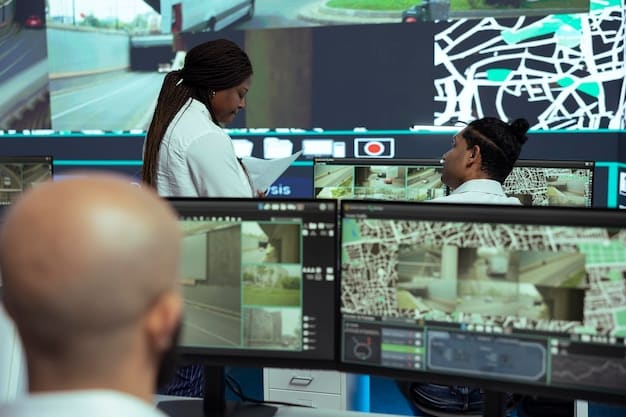
The Power of Real-Time Data in Urban Planning
Real-time data offers a powerful tool for urban planners to understand and address traffic congestion. By collecting and analyzing data from various sources, planners can gain insights into traffic patterns, identify emerging issues, and implement strategies to optimize traffic flow. This data-driven approach allows for more responsive and effective traffic management.
Sources of Real-Time Data
Real-time traffic data can be obtained from various sources, including:
- IoT sensors embedded in roadways and traffic signals
- GPS data from vehicles and mobile devices
- Traffic cameras providing visual monitoring
- Social media reports of traffic incidents
Benefits of Real-Time Data Analysis
Analyzing real-time data provides several benefits, such as:
- Identifying traffic bottlenecks and congestion hotspots
- Predicting future traffic conditions
- Evaluating the effectiveness of traffic management strategies
- Providing drivers with up-to-date traffic information
By leveraging these benefits, urban planners can make informed decisions to improve traffic flow and reduce congestion.
Implementing Adaptive Traffic Management Systems
Adaptive traffic management systems (ATMS) use real-time data to dynamically adjust traffic signals and optimize traffic flow. These systems can respond to changing traffic conditions, such as accidents, special events, and peak travel times, by adjusting signal timing to minimize delays and improve overall traffic efficiency.
How ATMS Works
ATMS systems typically involve the following components:
- Sensors to collect real-time traffic data
- Centralized control system to analyze data and generate signal timing plans
- Traffic signals that can be dynamically adjusted
Case Studies of ATMS Implementation
Several cities in the US have successfully implemented ATMS to reduce traffic congestion. For example:
- Los Angeles implemented an ATMS that reduced travel times by 12%
- New York City’s Midtown in Motion project reduced delays by 10%
- Dallas’s ATMS improved traffic flow by 15%
Leveraging GPS Data for Route Optimization
GPS data from vehicles and mobile devices can be used to optimize routes and reduce traffic congestion. By providing drivers with real-time traffic information and alternative route suggestions, GPS navigation systems can help distribute traffic more evenly across the road network and avoid congested areas.
How GPS Data is Used
GPS data is used in the following ways:
- Mapping real-time traffic conditions
- Identifying congested areas
- Calculating estimated travel times
- Suggesting alternative routes
Benefits for Drivers and Planners
GPS-based route optimization offers several benefits for drivers and urban planners:
- Reduced travel times for drivers
- Improved traffic flow
- Reduced fuel consumption and emissions
- Better understanding of traffic patterns for planners
By integrating GPS data into traffic management strategies, urban planners can significantly improve urban mobility.
The Role of IoT Sensors in Smart Traffic Management
The Internet of Things (IoT) plays a crucial role in smart traffic management by providing a network of connected devices that collect and share real-time data. IoT sensors embedded in roadways, traffic signals, and parking spaces can provide valuable information about traffic conditions, parking availability, and infrastructure performance. This data can be used to optimize traffic flow, improve parking management, and enhance overall urban mobility.
Types of IoT Sensors
Several types of IoT sensors are used in smart traffic management, including:
- Inductive loop detectors that measure vehicle presence and speed
- Acoustic sensors that detect traffic noise levels
- Video cameras that capture traffic images and videos
- Environmental sensors that monitor weather conditions
Applications of IoT Data
IoT data can be used in various applications, such as:
- Real-time traffic monitoring
- Adaptive traffic signal control
- Smart parking management
- Predictive maintenance of infrastructure
By leveraging IoT technology, urban planners can create more efficient and sustainable transportation systems.
Addressing Challenges and Ensuring Data Privacy
While real-time data offers significant benefits for urban planning, it also presents several challenges. These include data security, privacy concerns, and the need for robust data management systems. Addressing these challenges is crucial for ensuring the responsible and effective use of real-time data in traffic management.
Ensuring Data Security and Privacy
To protect data security and privacy, urban planners should:
- Implement strong encryption and access control measures
- Anonymize data to protect individual identities
- Develop clear data governance policies
- Comply with relevant data privacy regulations
Overcoming Technical Challenges
Technical challenges include:
- Data integration from multiple sources
- Data processing and analysis in real-time
- Data storage and management
- Ensuring data accuracy and reliability
By addressing these challenges and implementing best practices for data management, urban planners can maximize the benefits of real-time data while protecting data security and privacy.
| Key Point | Brief Description |
|---|---|
| 🚦Real-Time Data | Crucial for adaptive traffic management and route optimization. |
| 📱GPS Navigation | Helps drivers avoid congestion and improves traffic flow. |
| 🌐IoT Sensors | Provides critical data for smart traffic management systems. |
| 🔒Data Privacy | Must be ensured through anonymization and strong policies. |
FAQ
▼
Real-time traffic data comes from IoT sensors, GPS, traffic cameras, and social media. Each provides different insights into traffic conditions.
▼
Adaptive systems use real-time data to dynamically adjust traffic signals, optimizing flow and minimizing delays.
▼
GPS navigation provides drivers with real-time traffic updates and alternative routes, helping to distribute traffic more evenly.
▼
IoT sensors provide detailed data on traffic flow, parking availability, and infrastructure conditions, enabling more informed decisions.
▼
Challenges include ensuring data security, protecting privacy, integrating data from various sources, and maintaining data accuracy.
Conclusion
Leveraging real-time data is essential for US urban planners aiming to optimize traffic flow and reduce congestion. By implementing adaptive traffic management systems, utilizing GPS data for route optimization, and harnessing the power of IoT sensors, cities can make significant strides in improving urban mobility and creating more efficient transportation networks. How Can US Urban Planners Leverage Real-Time Data to Optimize Traffic Flow and Reduce Congestion by 10%? The answer lies in embracing innovation and deploying data-driven strategies.


